ASCENT TO THE VIRGIN OF PEÑAFURADA
We start the route in Posada de Omaña, being a route for both pedestrians and cyclists, following a forest track where we can find some ancient remains of Roman canals that supplied water to aquifer farms.
The route does not get lost as it is always following the same forest track. The hermitage of the Virgen de la Casa or Nuestra Señora de Peña Furada (Our Lady of Peña Furada), which we reach, brings together every 15th August the neighbours of the various adjoining municipalities such as Posada de Omaña, Vegapujín and Torrecillo, as well as those of the adjoining valley of Tremor.
MUNICIPALITY
Murias de Paredes
TYPE OF PATH
Pedestrian and cycle tourism (MTB)
COORDINATES
Start: 42° 47′ 52″ N, 6° 11′ 5″ W
Arrival: 42°45’58.46″N 6°12’17.52″O
TECHNICAL DATA
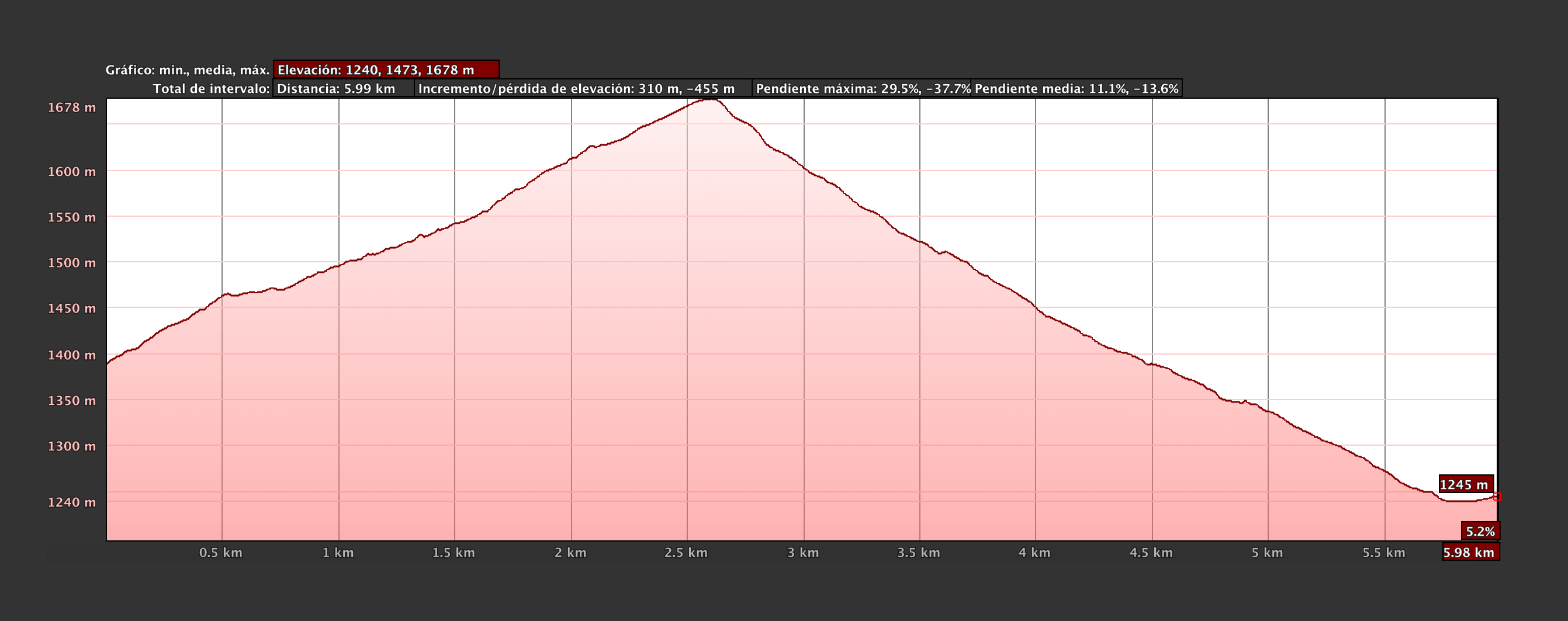
Approximate duration: 8 h 50 min (Round trip)
Distance: 12 km (Round trip)
Type of route: Linear
Difficulty: Easy
Elevation gain: 455 m
Maximum altitude: 1.678 m
Minimum altitude: 1.240 m
DOWNLOAD THE ROUTE
Click on the different versions and download the route directly to your gps device or smartphone – walk with all the info at your fingertips!


-


Ayuntamiento de Murias de Paredes Plaza del Ayuntamiento, 2 – C.P.: 24130 – MURIAS DE PAREDES (León – España)
Teléfono: 987 593 007 / 987 593 082 e-mail: info[@]sienteomana.com